GUIDANCE
Using Field Papers for Development
OVERVIEW
There are currently many geographic areas of the world that are not
Field Papers is a web-based mapping tool managed by
Stamen Design. It allows users to create a map from anywhere in the world (using data from adequately mapped. In the past, barriers including accessibility, conflict, and lack of GPS knowledge and equipment have made it difficult to document useful
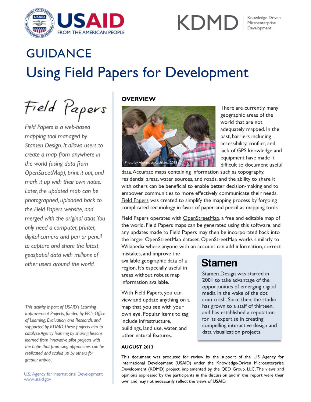
Photo by Alexander Kachkaev, 2013 data.Accurate maps containing information such as topography, residential areas, water sources, and roads, and the ability to share it with others can be beneficial to enable better decision-making and to
empower communities to more effectively communicate their needs.
Field Papers was created to simplify the mapping process by forgoing complicated technology in favor of paper and pencil as mapping tools.
OpenStreetMap), print it out, and mark it up with their own notes.
Later, the updated map can be photographed,uploaded back to the Field Papers website, and merged with the original atlas.You only need a computer, printer, digital camera and pen or pencil to capture and share the latest geospatial data with millions of other users around the world.
Field Papers operates with OpenStreetMap, a free and editable map of the world. Field Papers maps can be generated using this software, and any updates made to Field Papers may then be incorporated back into the larger OpenStreetMap dataset. OpenStreetMap works similarly to
Wikipedia where anyone with an account can add information, correct mistakes, and improve the available geographic data of a region. It’s especially useful in
Stamen Design was started in
2001 to take advantage of the opportunities of emerging digital media in the wake of the dot com crash. Since then, the studio has grown to a staff of thirteen, and has established a reputation for its expertise in creating areas without robust map information available.
With Field Papers, you can view and update anything on a map that you see with your own eye. Popular items to tag include infrastructure,
This activity is part of USAID’s Learning
Improvement Projects, funded by PPL’s Office of Learning,Evaluation,and Research,and supported by KDMD.These projects aim to catalyze Agency learning by sharing lessons learned from innovative pilot projects with the hope that promising approaches can be replicated and scaled up by others for greater impact. compelling interactive design and data visualization projects. buildings, land use, water, and other natural features.
AUGUST 2013
This document was produced for review by the support of the U.S. Agency for
International Development (USAID) under the Knowledge-Driven Microenterprise
Development (KDMD) project, implemented by the QED Group, LLC.The views and opinions expressed by the participants in the discussion and in this report were their own and may not necessarily reflect the views of USAID. Field Papers is a continuation ofWalking Papers
(created by Mike Migurski and Stamen Design) which was built for the OpenStreetMap community.
It first launched in May 2012 in partnership with
Caerus Associates and was upgraded in 2013 with funding from USAID.
OpenStreetMap is…
• A free street map of the world created by thousands of volunteers, similar toWikipedia
• A project where everyone can contribute
• Composed of more than 1,000,000 accounts
• A worldwide project in multiple languages
• Fully accessible in most urban areas
• Used in commercial applications
• Free!
WITH FIELD PAPERS,YOU CAN EASILY:
Make an Atlas to Print
Upload PagesYou’ve Marked
Create: Generate a map of anywhere in the world.
Just type in the location, and Field Papers will quickly pull up a map of the requested area.
Upload: Upload your edited Field Papers map from your computer using a variety of file formats (JPG,
PNG,TIF, or GIF).This is called a snapshot.
Customize:Adjust the size, detail, and display of your map with an easy-to-use map selection area.
Choose whether you would like your map to display in black and white (easier on your printer), in satellite view, or in the standard OpenStreetMap view.You can also have your map display on multiple pages if you like.
Annotate: Continue to draw on your snapshot in
Field Papers once it has been uploaded by adding markers and boundaries. For more advanced editing capabilities, you can connect to OpenStreetMap’s iD or Potlatch software.
Download or Export: Save your map as a PDF file or export into GeoJSON or a Shapefile, which are usable in other mapping and GIS software.
Save: Give your map a name and save it.You can choose to save it under your user account for future use, leave public, or mark as private.
Watch Other Maps
Track:View and access other maps and snapshots
Download and Print: Save your map as a PDF file and choose from three possible print layouts which can also leave room for your notes. that are being generated around the world.
Copy: Save some time by using maps that have already been created.
Mark:Take your map into the field and add additional features (such as roads or buildings) using a pen or a pencil.
Learn: Discover the many maps being created using
Field Papers and which are most popular under the metrics page.
MARK IT UP! TAKE A PHOTO!
MAKE AN ATLAS!
Visit fieldpapers.org to try it out and learn more!
GUIDANCE Using Field Papers for Development